
INFOS
Integrated Nowcast/Forecast Operation System
for Yahara Lakes
Partnership
![]()


Hydraulic
The hydraulic model is a 3-dimensional model providing water surface profile and discharge for the connecting rivers of the chain of lakes.
Nowcast Hydraulics:
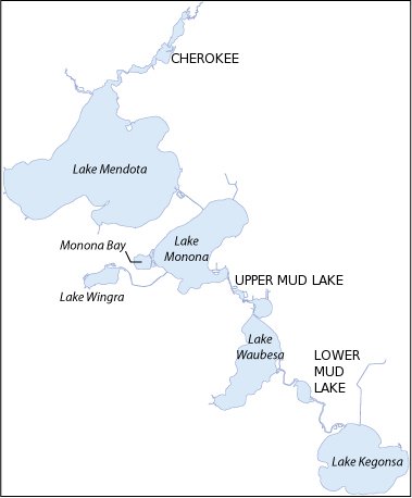
Cherokee
(Yahara River Inflow to Lake Mendota)
Upper Mud Lake
(Yahara River from Lake Monona to Lake Waubesa)
Lower Mud Lake
(Yahara River from Lake Waubesa to Lake Kegonsa)