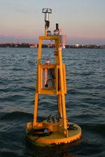
Lake Mendota Buoy
- LOCATION:
- Latitude 43.0995; Longitude -89.4045
- INSTRUMENT:
- The Lake Mendota buoy project is a collaboration between the University of Wisconsin Limnology, Space Science and Engineering Center (SSEC) and Environmental Engineering. The buoy measurements provide researchers valuable information to better understand the biological process governing the health of the lake and the impact of human activity on water quality. The buoy is located approximately 1.5 km North East of Picnic Point. The buoy measures both atmospheric and lake properties.


