
Lake Mendota Hydrodynamic Water Level Modeling

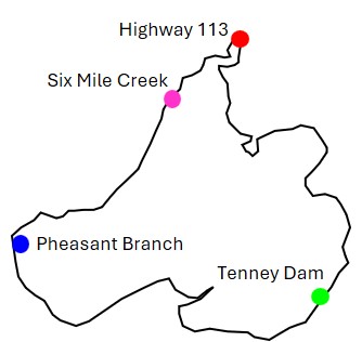
Lake Map with Modeling Output Locations

Lake Mendota Map

Highway 113: Lake Mendota Inflow Location at the Yahara River

Six Mile Creek: Lake Mendota Inflow Location at Six Mile Creek

Pheasant Branch: Lake Mendota Inflow Location at Pheasant Branch Creek

Tenney Dam: Lake Mendota Outflow Location at Tenney Dam


Water Level Model and Observations

Lake Mendota Water Level

Inflow - Yahara River at Highway 113

Yahara River at Hwy113

Wind Speed and Direction

Wind